An excerpt from the land acknowledgement:
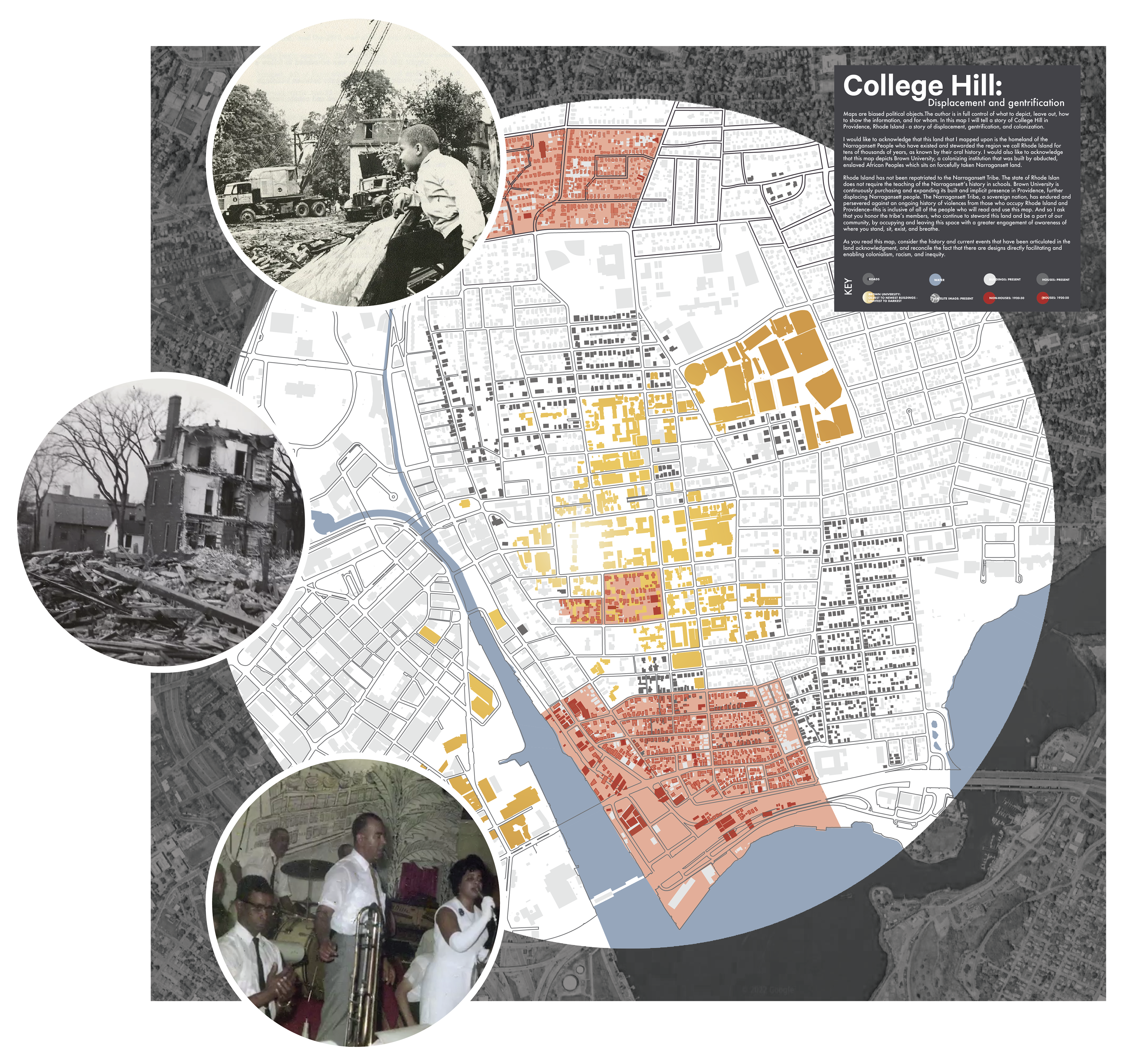
Maps are biased political objects.The author is in full control of what to depict, leave out, how to show the information, and for whom. In this map I will tell a story of College Hill in Providence, Rhode Island - a story of displacement, gentrification, and colonization.
I would like to acknowledge that this land that I mapped upon is the homeland of the Narragansett People who have existed and stewarded the region we call Rhode Island for tens of thousands of years, as known by their oral history. I would also like to acknowledge that this map depicts Brown University, a colonizing institution that was built by abducted, enslaved African Peoples which sits on forcefully taken Narragansett land.
Brown University is continuously purchasing and expanding its built and implicit presence in Providence, further displacing Narragansett people. The Narragansett Tribe, a sovereign nation, has endured and persevered against an ongoing history of violences from those who occupy Rhode Island and Providence---this is inclusive of all of the people who will read and use this map. And so I ask that you honor the tribe’s members, who continue to steward this land and be a part of our community, by occupying and leaving this space with a greater engagement of awareness of where you stand, sit, exist, and breathe. As you read this map, consider the history and current events that have been articulated in the land acknowledgment, and reconcile the fact that there are designs directly facilitating and enabling colonialism, racism, and inequity.
Interactive version of the map coming soon.